Category Archives: Uncategorized

Benteng Vredeburg Yogyakarta

Standard
Benteng Vredeburg Yogyakarta

Benteng Vredeburg Yogyakarta


Benteng Vredeburg Yogyakarta

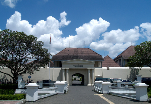
Benteng Vredeburg, Yogyakarta is better known as the Vredeburg Fort. This particular fort is located opposite the Gedung Agung. This fort has stood the ravages of time and now it stands as a victorious structure and so it is considered to be one of the main spots that one should make it a point to visit.

The Benteng Vredeburg, Yogyakarta was built by the Dutch government in 1765. It was built when Yogyakarta was under the domination of the Dutch. This fort has a fascinating history behind it. It was built so that it could be used to anticipate the canon shots that would be shot by the Sultan’s army. The fort was also built to provide protection to the Dutch Residence here.

The particularities of the Benteng Vredeburg, Yogyakarta

The place is an architectural delight. The entire area of the fort is surrounded by moats. These have been well maintained and these can be seen even today. The entire fort has a rectangular shape. There is also a citadel or a bastion like structure at the corner. This allowed ample space for the soldiers to walk on and get a proper shot at the enemy.

There is a bastion at the southern end of the Benteng Vredeburg, Yogyakarta. It also has a canon from where the view is wonderful. You can see the Sultan’s Palace in all its splendor and glory. Besides this there are also a number of other historical monuments around the Palace that can be seen from this point. The hustle and the bustle of Yogyakarta and the traffic can also be seen from here.

One can easily reach the Benteng Vredeburg, Yogyakarta by taking a leisurely walk from the municipality center. This would also give you the chance of taking in the flavors of the place and feel the colors and essences of Yogyakarta.

Baron Beach Yogyakarta Indonesia

Standard
Baron Beach Yogyakarta Indonesia

Baron Beach Yogyakarta Indonesia

Baron Beach Yogyakarta

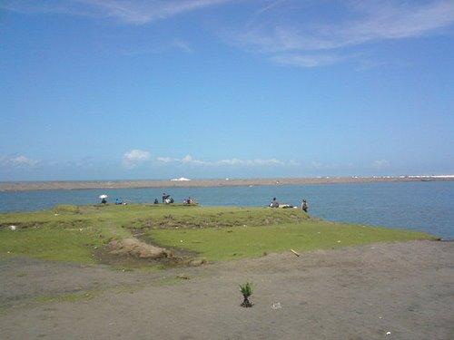
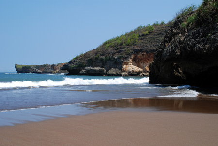
The Baron Beach in Yogyakarta is tranquil and beautiful and is located towards the southeastern side of Yogyakarta. The beach actually lies in the Kemandang Village in the Tanjungsari.

Features of the Baron Beach in Yogyakarta:

– It is a famous fishing destination and is also known for its natural beauty. Near the beach is an underground river where people often take a bath after playing on the beach.

– There is also a beautiful limestone hill in this region and if you travel through the winding roads of the mountain, you can find the two attractive green coral ridges that are also the prime attraction of the bay. A tour through the hill is really fascinating, and you will find yourself passing by an interesting place called the Pegunungan Seribu which when translated into English means   – a thousand mountains”. You can have a magnificent view of the beach from the mountain and while climbing the steep hill you would also be able to satisfy your appetite for adventure.

– There are also many seafood stalls on the Baron Beach that sell tasty sea and fresh sea fishes at a very cheap rate. There are also special food items like Baron’s Kakap fish soup whose taste would linger in your mouth forever!

– In every Syuro month, which is the first month of the local calendar, you will find a huge crowd of fishermen making offerings to the sea in order to propitiate God and also express their thankfulness for the fish they are able to collect and they also pray for good luck in fishing. This unique festival is called the Labuhan.

Other beautiful beaches around the Baron Beach:

The Drini Beach, the Krakal Beach, the Kupkup beach, the Wediombo Beach, the Saden and Siung Beach are among the many that you will find only a short distance from the Baron Beach.

Samas Beach Yogyakarta

Standard
Samas Beach Yogyakarta

Samas Beach Yogyakarta

Samas Beach (Kecamatan Sanden Bantul DI Yogyakarta)

Samas Beach is located at the west of Parangtritis beach, at Srigading village, District of Sanden, more or less 14 (fourteen) kilometres on southward of Bantul. From Yogyakarta, you could travel to the southwest for 35 (thirty five) kilometres from downtown. Samas Beach is easy to visit with private or public vehicles since the road is good. Your journey to Samas would be fun with beautiful scenery of rice field and coconut tree along the street.

Samas is famous of it beautiful beach with strong winds, big waves, delta from rivers, and white water lake which is developed to improve fish and prawn farming by the government. However the beach is very dangerous so you have to be very careful.

At the white sand beach, you can enjoy the sea by going to Mercusuar Patehan. There are also bus terminal, parking area, toilet, motels, SAR, electricity, mushalla, and restaurant. Several cultural ceremony are also held at Samas beach such as Kirab Tumuruning Maheso Suro, sea offerings, art and culture exhibition (on holidays and Lebaran days).

Taman Sari Water Castle

Standard
Taman Dari Water Castle

Taman Sari Water Castle

Taman Sari (Yogyakarta)

From Wikipedia, the free encyclopedia

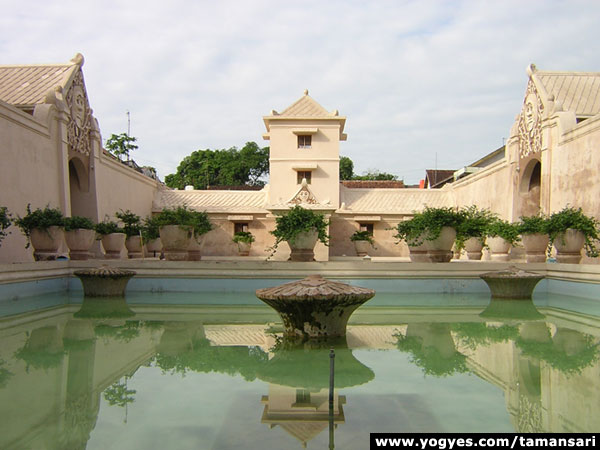
Taman Sari also known as Taman Sari Water Castle is a site of a former royal garden of the Sultanate of Yogyakarta. It is located about 2 km south within the grounds of theKratonYogyakartaIndonesia. Built in mid 18th century, the Taman Sari had multiple functions, such as a resting area, a workshop, a meditation area, a defense area, and a hiding place.[2]

Taman Sari consisted of four distinct areas: a large artificial lake with islands and pavilions located in the west, a bathing complex in the centre, a complex of pavilions and pools in the south, and a smaller lake in the east. Today only the central bathing complex is well preserved, while the other areas have been largely occupied by the Kampung Tamansettlement.

Since 1995 the Yogyakarta Palace Complex including Taman Sari is listed as a tentativeWorld Heritage Site.[3][4]

Etymology

The name Taman Sari comes from the Javanese words taman, meaning a “garden” or “park” and sari, which means “beautiful” or “flowers”. Hence, the name Taman Sari means an area of a beautiful garden adorned with flowers. An old article described it as a “water castle” (Dutchwaterkasteel); as by shutting the watergates, the complex would be completely immersed in water, leaving tall structures standing out.[5]

History

The building of Taman Sari commenced during the reign of Sultan Hamengkubuwono I (1755–1792), the first sultan of the Yogyakarta Sultanate, and was completed by the time of Sultan Hamengkubuwono II. The building site, however, had already been known as a bathing place called Pacethokan Spring since Sunan Amangkurat IV’s reign (1719–1726).[6][7] According to Kitab Mamana in Yogyakarta Kraton, the project leader for the construction of Taman Sari was Tumenggung Mangundipura. He had travelled twice to Batavia to learn about European architecture, which is the reason why the architecture of Taman Sari has marks of European style.[8] The Regent of Madiun, Raden Rangga Prawirasentika, participated in funding the construction of Taman Sari. Prawirasentika also beseeched the Sultan to be relieved of Madiun’s tax obligation. He offered other alternative ways of payment. The Sultan accepted his proposal. In 1758, the Sultan commanded the Regent to supervise the making of bricks and various complements, which would be used to build a beautiful garden. The sultan wanted a place where he could spend some time to relax after many years of wars that he had just experienced. Raden Tumenggung Mangundipura, under supervision of Raden Arya Natakusuma (who later became Sri Pakualam II), was responsible for the construction. The building was started in 1684 Javanese year (1758 AD). After finding out how large the complex was, Raden Rangga Prawirasentika realized that the cost would have been greater than the taxes. He resigned from the project and was replaced by Prince Natakusuma who continued the project to completion.[9][10]

Taman Sari was built three years after the Giyanti Agreement as a resting place for Sultan Hamengkubuwono I. The complex consists of about 59 buildings[4] including a mosque, meditation chambers, swimming pools, and a series of 18 water gardens and pavilions surrounded by artificial lakes. The complex was effectively used between 1765-1812.[11]

The British invasion of the Yogyakarta Kraton saw considerable parts of the complex destroyed in 1812.[12]

The building of Taman Sari ended upon the completion of the gates and the walls. A sengkalan memet (a Javanese chronogram)[13][14] on the western gate (Gedhong Gapura Hageng) marks the year with the Javanese words Lajering Kembang Sinesep Peksi, denoting the Javanese year of 1691 or about 1765: lajering, “core” for 1; kembang, “flower” for 9; sinerep, “suck” or “drink” for 6; peksi, “bird” for 1; the sentence can be read as “birds gathering pollen of the flower”. The relief around this sengkalan memet shows birds siphoning honey from flowery trees.

The maintenance of Taman Sari was abandoned shortly after Hamengkubuwono I died, partly because the elaborate hydraulic works were so difficult to maintain. The gardens were neglected and the buildings suffered some damage during the Java War of 1825-1830.[6]

A late 19th century photo of the Kenongo building in ruins. The surrounding area, once the Segaran lake, is dry and filled with plants. Today the lake is filled with buildings and the Kenongo building is still in ruin.

The palace complex fell out of use following an earthquake in 1867, which destroyed several buildings and drained the water features. Over time, squatters began to inhabit the site, surrounding the ruins of the deserted pavilions and filling the empty lakebeds.[6]

In early 1970s, effort at restoration was made. Only the bathing complex has been completely restored.[6]

Demang Tegis

The manuscript of Serat Rerenggan mentions the story of Demang Tegis, a Portuguese man said to be one of the architect of Taman Sari. According to the manuscript, a strange man suddenly appeared in Mancingan Village (a locality name on the south coast of Java nearParangtritis). With long nose, white complexion, and a foreign language, the villagers suspected that the person was some kind of spirit or forest fairy. They presented him to the current sultan, Hamengkubuwono II. Apparently the sultan found interest in the person and took the strange man as his servant. Some years had passed and the man had finally learned to talk in Javanese. According to him, he was a Portuguese (or in Javanese, Portegis) who was stranded from a shipwreck. He also claimed to have been a housebuilder, so the sultan ordered him to erect a fortress. Satisfied by the man’s work, the sultan gave him the title “demang.” From then on that person was known as Demang Portegis or Demang Tegis.[15]

There is a controversy whether Demang Tegis was actually the architect of Taman Sari, as the design resembles a hybrid of Javanese and Dutch styles, rather than Portuguese. P.J. Veth, in Java – Book III, page 631 wrote, “Local research says that [Taman Sari’s architecture] was designed by either a Spanish or Portuguese engineer, who was stranded off his sunken ship at the southern beach. However, [the architecture] that strongly shows Javanese character contradicts this.”[16] The evidence about Demang Tegis remains a inconclusive, yet the architecture of Taman Sari moved a number of Portuguese experts on architecture and cultural heritage to examine the Taman Sari in 2001.[11][17]

The widespread assumption of European influence in the design of Taman Sari has been also challenged by the research of Hélène Njoto-Feillard from the University of Pantheon-Sorbonne, presented in a 2003 conference paper. Analysing the historic context and architectural style of the complex, the conclusion is that the creators are most likely local Javanese. The absence of any mention of European involvement in the construction of Taman Sari in Dutch historic descriptions is presented as further evidence in support of this hypothesis.[4]

Buildings

Taman Sari can be divided into four areas. The first area is the artificial lake Segaran located in the west. The second area is a bathing complex in the south of the Segaran lake, called the Umbul Binangun bathing complex. The third area, now completely gone, is thePasarean Ledok Sari and Garjitawati Pool, located in the south of the bathing complex. The fourth area is the east side of the first and second area, which extend far to the east and to the southeast complex of Magangan.

The Segaran lake area

Row of small Tajug buildings that functioned as air vents for the underground tunnel. On the left is the ruin of the Cemethi Island. On the background to the right is the eastern gate of Gedhong Gapura Panggung. The area, once an artificial lake, is now filled with settlements

The Segaran lake area was the main complex of the Taman Sari during its era. This complex consisted of a man-made lake called Segaran (“artificial sea”) with some buildings located on artificial islands in the middle of a lake. The buildings are connected by an underwater tunnel. It was used as the starting point for the royal family to reach the Taman Sari pools via a vessel. Today, the Segaran lake cannot be seen any longer as the water had been drained and the lake bed is now filled with human settlements. The underwater tunnel, which is now underground after the water had gone, still exist and can be accessed.[4][18][19]

In the middle of Segaran was an artificial island known as Kenongo Island (JavanesePulo Kenongo). It was named after the cananga trees which once covered the island. On this island is a one-storeyed structure called the Kenongo building (JavaneseGedhong Kenongo), now in ruins.[4][18][19]

On the south side of Kenongo Island is a row of small buildings called the Tajug. These buildings were originally used as air vents for the tunnel located below the lake. This underground tunnel, constructed in 1761,[20]was an alternative way to reach the Kenongo Island other than by a vessel. Also on the south side of the Kenongo Island is another artificial island called Cemethi Island (Javanese Pulo Cemethi) or Panembung Island (Javanese Pulo Panembung). It is a one-storeyed structure for the Sultan to meditate, or some said, a hiding place for the royal family during an attack. Another name for this island is Sumur Gumantung, because on the south side of this island is a well that hangs above the ground. This place could only be reached via the underwater tunnel. The building of Cemethi Island is now also in ruin.[18] A legend says that there is a secret tunnel that connects the palace with the south sea (Indian Ocean) where Nyai Roro Kidul or the Queen of the South has her palace.[21] The supernatural Queen becomes the spiritual wife of Yogyakarta Sultan for many generations.[19][22]

The elevated platform inside Sumur Gumulingwhere the four staircases meet in the center.

On the west side of Kenongo Island is another one-storeyed circular structure that forms another artificial island in the past called Gumuling Well (Sumur Gumuling). These one-storeyed building can only be entered via the underwater tunnel. The building was used as a mosque. A niche in the wall of this building was used as a mihrab. The central area of this building is an elevated platform where four staircases meet, and then from the platform, one staircase reach the first floor. On the ground level of this platform is a small pool that was used for Muslim ritual ablution.[4][11][19]

The bathing complex

The second area is located on the south of the former artificial lake of Segaran. Even though this area was not the focal point of Taman Sari, it is the best preseved area in the complex and is currently the most popular tourist attraction. The area is accessed via two gates on the east and the west side, each of these gates leads to the center of the complex, first to an inner octogonal-shaped courtyard on the east and the west, and then each of these courtyards leads to a central bathing complex in the center.[18][19]

The gates

The western gate of Gedhong Gapura Hageng in early 20th century. Today it has been restored.

There are two gates that lead to the bathing complex, the western one called Gedhong Gapura Hageng and the eastern one called Gedhong Gapura Panggung. Both gates are decorated with ornaments of stylized birds and flowering foliages.[4][18][19]

The west entrance, the Gedhong Gapura Hageng was formerly used as the main entrance to the bathing complex. The east facade of the gate is still visible today, but the west facade is blocked by settlements. The construction of this gate was finished in 1691 Javanese Year (about 1765 AD). The east entrance, the Gedhong Gapura Panggung is still functioning as a gate and is now the main entrance for tourists. The east entrance is a building with four staircases, two on the west side and two on the eastside. Four nagas once decorated this gate, now there are only two nagas left. The building was finished in 1684 Javanese calendar (about 1758 AD).[4][18][19]

[edit]The octagonal courtyards

Each of the gates leads to an octagonal-shaped courtyard. The western gate leads to a western octagonal-shaped enclosed courtyard. In the past, a building stood in the center of this courtyard, which was called the Lopak-lopak building (Javanese Gedhong Lopak-lopak).[18][19]

The eastern gate leads to an octagonal-shaped enclosed courtyard as well. It has a similar layout with the Gedhong Lopak-lopak courtyard, but within it, there are four pavilions known as Gedhong Sekawan. These pavilions were used as the resting place for the royal family.[18][19]

The eastern and the western octagonal courtyards lead to the central bathing complex.

Umbul Pasiraman bathing complex

The gate in the bathing complex that leads to the eastern octagonal courtyard

Umbul Pasiraman, also known as Umbul Binangun or Umbul Winangun, is a bathing complex for the royal family. The bathing complex is an enclosed space surrounded by tall structures. It consists of three pools decorated with mushroom-shaped springs and large flower pots.[18][19]

There are two buildings in the bathing complex. The northernmost building was used as the resting place and changing room for the daughters and concubines of the sultan. On the south side of this building is a pool known as Umbul Muncar. The pool is divided into two by a central pathway (known as Blumbang Kuras) that runs east-west. The next building on the south is a building with a tower in its center. The right wing of the building was used as the sultan’s changing room, the east wing was used as his resting place. The central tower was used by the sultan to observe his daughters and concubines bathing in the pool.[18][19]

On the south of this building is the third pool that was used only by the sultan and his concubines. During its era, only females and the sultan were allowed to enter this bathing complex.[18][19]

Gedhong Temanten

Gedhong Temanten buildings. In the background is the eastern gate, Gedhong Gapuro Panggung

On the southeast and northeast of the Gedhong Gapuro Panggung are two buildings known asGedhong Temanten. The buildings were formerly used by the castle guard. According to archeological study, on the south side of this building was another building and a garden whose remain cannot be seen anymore and is filled with settlements.[18][19]

[edit]The third area

This area that is located south of the bathing complex, but no visible remains are left. According to a reconstruction of the site, this complex consisted of the complex of Pasarean Dalem Ledok Sariand the pool complex of Garjitawati with several pavilions and a garden. Pasarean Dalem Ledok Sari is the only part of the complex that is still protected. Pasarean Dalem Ledok Sari was probably used as a meditation place for the sultan, or some said as the meeting place for the sultan and his concubines. In the middle of the building was also a sleeping room for the sultan with water flowing beneath it. There was also a kitchen, a looming room, a storage, two pools for the servants, and a garden.[18][19]

[edit]The fourth area

The fourth complex is the part of the Taman Sari complex that is practically has no visible remains, except for a former hanging bridge and remains of a pier. The description of this area is retrieved from a reconstruction made from the 1812 English army sketch of the Yogyakartakraton. This area extends about 600 meters to the east of the Segaran lake area. This area consisted of another artificial lake on the southeast of the Magangan complex toward the northeast of Siti Hinggil Kidul complex. In the middle of this artificial lake is another artificial island called Kinupeng Island (Javanese Pulo Kinupeng). A building, known as Gading building (Javanese Gedhong Gading) stood in the middle of the island.[19][23]

This artificial lake is connected to the east side of the Segaran Lake via a 380 meter long canal that runs east to west. The canal was about 20 meter wide and there are two bottlenecks that are thought to be the place where a hanging bridge once stood. One of the bridge is now located in the street that connects the kraton complex of Magangan with the Kamandhungan Kidul. The layout of the bridge can still be recognized, although the bridge itself has gone. On the west side of the hanging bridge is a pier that was used by the sultan as his starting point for his journey to the Taman Sari pool on his royal vessel.[19][23]

The canal is bounded on the south and north with a garden, now located on the west side of the kraton complex of Kamanghungan Kidul and Siti Hinggil Kidul. Today, all of these canals, bridges, lakes, and gardens have been filled with local settlements; the garden becomes the Kampung Ngadisuryan, the lake becomes the kampung Segaran.[19][24]

Around Taman Sari

2010 Photo of female Batik painter living around Taman Sari (Kampung Taman) crafting batik.

Today, the area around the Taman Sari castle complex is occupied by a settlement calledKampung Taman with 2,700 residents. The community is known for their batik and traditional painting craft traditions. Also located in this area is the Ngasem Traditional Market (Pasar Ngasem), the biggest bird market in Yogyakarta, and the Sokotunggal mosque, a unique mosque built in the early 20th century with a single pillar that is different from the usual Javanese traditional architecture.[6]

Notes

  1. ^ Brongtodiningrat, K. P. H. (1978) (in Indonesian). Arti Kraton Yogyakarta / oleh K. P. H. Brongtodiningrat ; diterjemahkan secara bebas dalam bahasa Indonesia oleh R. Murdani Hadiatmaja. Yogyakarta: Museum Kraton Yogyakarta. p. 7. Retrieved April 6, 2010.
  2. ^ Tjahjani, Indra (2005). Taman Sari Yogyakarta: a cultural perspective in landscape design. University of Canberra. School of Design and Architecture. p. 146. Retrieved April 8, 2010.
  3. ^ “World Heritage Tentative List: Yogyakarta Palace Complex”UNESCO. Retrieved 2010-04-06.
  4. a b c d e f g h Hélène Njoto-Feillard (September 24–25, 2003). “Notes sur l’identité des modèles architecturaux du Taman Sari de Yogyakarta (1758-1765)”(in French). http://www.reseau-asie.com. pp. 2–14. Retrieved April 6, 2010.
  5. ^ Oey, Eric (1994). Java: Garden of the East. Passport Books. pp. 161–163.ISBN 0844299472, 9780844299471. Retrieved April 8, 2010.
  6. a b c d e Oey, Eric (1997). Java, Indonesia – Periplus Adventure Guide Series. Singapore: Periplus Edition (HK) Ltd.. pp. 161–164. ISBN 962-593-244-5. Retrieved April 4, 2010.
  7. ^ Margantoro, J.B.; Nusantara (1999) (in Indonesian). Sri Sultan Hamengku Buwono X: meneguhkan tahta untuk rakyat. Gramedia Widiasarana Indonesia bekerja sama dengan Harian Bernas Yogyakarta. p. 160. ISBN 9796695707, 9789796695706. Retrieved April 8, 2010.
  8. ^ International Federation of Landscape Architects (2009). Paradise on Earth: the gardens of the XXI century : the 3rd International Federation of Landscape Architects World Congress, Florence, Italy , 12–15 October 1996, Volume 1. Florence: Italian Association of Landscape Architecture. pp. 133–136.
  9. ^ (in Indonesian) Serat rerenggan kraton. Depdikbud. 1981. p. 55. ISBN 9799573173, 9789799573179.
  10. ^ Ricklefs, MC (1974). Yogyakarta Under Sultan Mangkubumi. London: Oxford University. p. 85. ISBN 0197135781.
  11. a b c Dharmamulja, Sukirman (1981) (in Indonesian). Mengenal sekilas bangunan Pasanggrahan Tamansari, Yogyakarta. Yogyakarta: Departemen Pendidikan dan Kebudayaan, Direktorat Sejarah dan Nilai Tradisional, Balai Penelitian Sejarah dan Budaya. p. 28. ISBN 83940311 (LCCN). Retrieved April 6, 2010.
  12. ^ Arya Pangéran, Panular; P. B. R, Carey; British Academy (1992). The British in Java, 1811-1816 : a Javanese account. Oxford: Oxford University Press. p. 403.ISBN 0197260624.
  13. ^ Sengkalan is a symbolic play of words to describe a year with important events (e.g. births, marriages, deaths, building construction, etc). It is used by Javanese scholars and the upper-middle tier of society. A sengkalan used certain objects as symbols to describe the numbers 0 to 9. A general example, although there are many, of these numerals and their corresponding symbols are: 0 = langit/sky, 1 = bumi/earth, 2 = mripat/eyes, 3 = geni/fire, 4 = segara/sea, 5 = maruta/wind, 6 = rasa/feeling, 7 = giri/mountain, 8 = liman/elephant, 9 = bolong/hole.
  14. ^ G., Eko Punto Hendro (2001) (in Indonesian). Kraton Yogyakarta dalam balutan Hindu. Jakarta: Bendera. p. 55.ISBN 9799573173, 9789799573179.
  15. ^ Candranegara I (1986) (in French).Pérégrinations javanaises: les voyages de R.M.A. Purwa Lelana : une vision de Java au XIXe siècle (c.1860-1875)Volume 7 of Etudes insulindiennes-Archipel. Editions MSH. p. 335. ISBN 273510155X, 9782735101559. Retrieved April 8, 2010.
  16. ^ “Zegt dat het ontwerpen werd door een Spaansch of Portugeesch De overlevering ingenieur die als schipsbreukeling op het zuiderstrand was geworpen, maar het echt Javaansch karakter vab het geboew schijnt daarmete in strijd” – Sabdacarakatama (Ki.) (2009) (in Indonesian). Sejarah Keraton Yogyakarta. Penerbit Narasi. p. 53.ISBN 979168104X, 9789791681049. Retrieved April 7, 2010.
  17. ^ “Taman Sari shows foreign architectural touches”Jakarta Post. April 27, 2002.
  18. a b c d e f g h i j k l m Tjahjani, Indra (2005).Taman Sari Yogyakarta: a cultural perspective in landscape design. University of Canberra. School of Design and Architecture. p. 193.
  19. a b c d e f g h i j k l m n o p q Jacques, Dumarçay (Tome 65, 1978) (in French). Le Taman Sari. Étude architecturale. In: Bulletin de l’Ecole française d’Extrême-Orient. Bulletin de l’Ecole française d’Extrême-Orient. pp. 589–597.doi:10.3406/befeo.1978.3916. Retrieved April 9, 2010.
  20. ^ Soekiman, Djoko (1992) (in Indonesian).Taman Sari. Jakarta: Departemen Pendidikan dan Kebudayaan. p. 37. Retrieved April 8, 2010.
  21. ^ Ricklefs, MC (1974). Yogyakarta Under Sultan Mangkubumi. London: Oxford University. p. 83.
  22. ^ Brongtodiningrat, K. P. H. (1978). Arti Kraton Yogyakarta / oleh K. P. H. Brongtodiningrat ; diterjemahkan secara bebas dalam bahasa Indonesia oleh R. Murdani Hadiatmaja. Yogyakarta: Museum Kraton Yogyakarta. Retrieved April 6, 2010.
  23. a b Thorn, William (1993). The Conquest of Java (Periplus Edition, reprinted, originally 1815). Antiques of the Orient Pte. Ltd. p. 174.ISBN 0945971869, 9780945971863.
  24. ^ Soedarisman Poerwokoesoemo, K.P.H. (1985). Kadipaten Pakualaman. Gadjah Mada University Press. p. 44.

Dieng Plateu Wonosobo

Standard
Dieng Plateu Wonosobo

Dieng Plateu Wonosobo

DIENG PLATEAU – The Strange Beauty of Java, Indonesia

Arjuna Temple, The Mysterious Peaceful Three-Headed Shiva PalaceTelaga Warna (the Colorful Lake), Beautiful Twin Lakes

Dieng name derived from Sanskrit language which is “di” means the place and “hyang” means Gods. Overall Dieng can be defined as a place of the Gods. While the residents said Dieng derived from the word “edi” which means beautiful in the Java language, and “aeng” meaning strange. In other words Dieng is a beautiful place with a lot of oddities.

Located at an altitude of 2000 meters above sea level, Dieng community should be grateful for the abundance of wealth which conferred upon their beautiful and exotic land. Candi Arjuna (Arjuna Temple) Complex which is the oldest Hindu temple in Java is still standing upright in the middle of whipping time and weather, as the evidence of the cultural heritage of an extraordinary wealth. Although some parts of the temple began to wear out with age, the worship of Shiva temple built in 809 AD is still stand sturdy giving the peaceful feeling in the midst of the natural silence of the mountains.

The cold weather has led to the unique style of dress of its people. Temperatures during the day ranged between 15-20 degrees Celsius while in the night between 10 degrees Celsius. In July and August temperatures can reach 0 degrees Celsius during the day and -10 degrees Celsius at night.

The residents are taking advantage of the cold air to maximize their farms. Their abundant land converted into fields for growing various vegetables and fruits. The main commodities are potatoes and cabbage. Carica, typical papaya of Dieng is turned into delicious meals that always hunted as typical souvenir of Dieng. Purwaceng, a wild grass that grows, turned into a nutritious drink to increase male masculinity. Speaking of culinary, a must try food of Dieng is the delicious Tempeh Kemul and the legendary Mie Ongklok Wonosobo.

Dieng is an active volcanic region and can be regarded as a giant volcano. Plains formed from volcanic crater that has died. Crater shape can be seen obviously from the plain with mountains cluster surrounding. Yet despite this volcano has been dead for centuries, some volcanic craters are still active until now. Among these is Kawah Sikidang (Sikidang Crater), which is always on the move and jumping like a “kidang” or deer.

The uniqueness of the formation process produced an exotic landscape. Telaga Warna (Colorful Lake) that reflects the color green, blue and purple and enchanting the beauty of sunrise from the summit of Gunung Sikunir (Mount Sikunir) is the places that should not be passed just like that.

The land trusted as the place of the God, mystical aura and myth still believed by many indigenous people of Dieng. One is the phenomenon of anak gimbal (dreadlocks kids). For some reasons many children in this region was suddenly turned into dreadlocked. They were born normal, just like the other children, but then got a sudden high fever and grew dreads on their heads. Most people believed that children are the decendent of “pepunden” or ancestral founder of Dieng. They are then have to go through a cut ritual, after their demand were granted by the parents. When the parents fail to comply, the dreads will grow again though it has been cut many times.

From Yogyakarta to Dieng

Dieng is located approximately 116 km from Yogyakarta. To get to the Dieng Plateau, you can use your own car or rental car directly to Dieng within 3.5 hours. For those of you who choose public transport, bus and travel (door to door minibus) are available to take you to reach Wonosobo. After that, the trip continued with a micro-bus to Dieng for about 1 hour. Natural scenery of green mountains along the road will pamper your eyes and eliminate the anxiety of going uphill road which constantly twisting.

Travel costs Yogyakarta – Dieng:

  • Yogyakarta – Wonosobo (by minibus): IDR 40,000
  • Wonosobo – Dieng (by microbus): IDR 8,000

Note:
Data obtained from the trip in October 2010. This page is not always updated and there is the possibility of price changes at any time.

Solo Sultan Palace

Standard

sultan palace solo surakarta

SOLO – SoLovely Java

SOLO (often called Surakarta) is the neighbor city of Yogyakarta in Java Island, Indonesia. Most of the tourists are visiting Yogyakarta, but actually Solo has also many marvelous tourist attractions of its own.

Approximately 15 km north of Solo, there is an important archaeological site, namely Sangiran. In that place, it was found the primordial man who lived in Java Island a million years ago. Half of all primordial man fossils in the world were found in Sangiran. Therefore, UNESCO established Sangiran as World Heritage site.

At the foot of Mount Lawu which is not far from the City of Solo, standing Sukuh and Cetho Temples. Sukuh Templeis one of the most interesting temples in Southeast Asia. Its architecture resembles a Mayan tribe’s stepped pyramid in Central America. However, the most unique part of this temple is its erotic ornaments. It is said that Cetho and Sukuh Temple were the last temples built in Java Island along with the downfall of Majapahit Kingdom and the influence of Hindu.

The reign of Majapahit in Java Island was later replaced by Islamic Kingdoms. Giyanti Agreement in 1755 divided Islamic Mataram Kingdom to Kasunanan Surakarta which was located in Solo and Yogyakarta Sultanate which was founded in the city of Yogyakarta. History has shown that Surakarta and Yogyakarta have a kindred relationship.

Those both cities are the cradle of Javanese culture. Hundred years being one of the Javanese culture centers inspired the slogan Solo the Spirit of Java. The achievement of Solo in dance and batik for example, is truly remarkable. Solo is often called as the capital of batik. In this city, there is Laweyan Batik Village where is the place of batik artisan for centuries. There is also an ancient batik museum of Danar Hadi, the best and most complete batik museum in the world.

Sight-seeing and dining are two important points in the tour. Solo city has no shortage of delicious traditional cuisines. For instance, Nasi Liwet Wongso Lemu, an authentic food which has savory rice with tasty areh (special cooked coconut milk) served on banana leaf or pincuk. There are also food made of cooked young jackfruit, Gudeg Ceker Margoyudan that is only open early morning, soft and sweet Javanese pancake of Serabi Notosuman and dozens of places to taste the famous traditional food recipes.

The tour will not be complete without buying any souvenirs. Klewer MarketBeteng Trade Center to Windujenar Market where is a “heaven” for hunting typical souvenirs of Solo from Batik to antique stuffs.

From Yogyakarta to Solo (Surakarta)

Solo is located only 65 km northeast of Yogyakarta and can be reached within 1,5 hours drive by economy bus which is 24 hours available. Pramex train is serving the route of Yogyakarta – Solo 10 times every day. Any taxis and car rentals will be glad to take you to Solo at anytime.

Solo Adisumarmo International Airport in Surakarta also has direct flight from Jakarta, Denpasar (Bali), Kuala Lumpur (Malaysia) and Singapore.

Sultan Palace Yogyakarta Indonesia

Standard
sultan palace yogyakarta

sultan palace yogyakarta

KRATON – The Palace of the Sultan of Yogyakarta

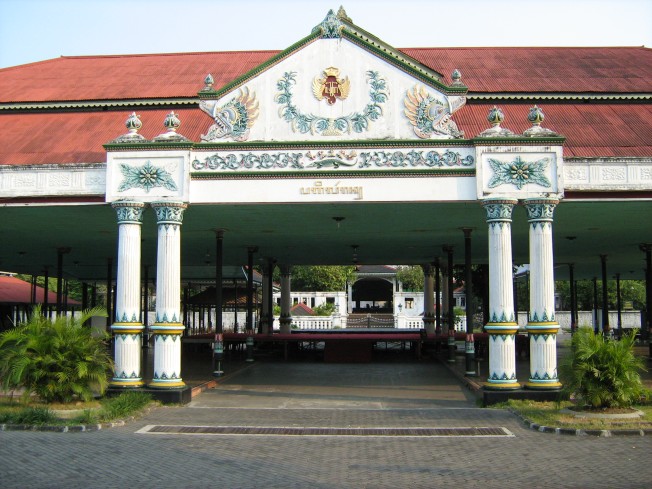
Kraton or the Palace where Kraton the Palace where Sultan and his family of Yogyakarta live is located in the center of the axis stretching from the north to the south, and in the secondary axis from the east to the west. It is encircled by row of the mountains called the Horizon as the border of the universe.

It lies between Tugu as the north border and Panggung Krapyak as the south border, between Code River in the east and Winongo River in the west; between the Merapi Mountain and the South Sea. In the mind of the Javanese community, kraton is defined as center of the world that is described as center of the universe.

After the Giyanti Agreeement, Yogyakarta territory was given to Pangeran Mangkubumi. To run his governance, he built a palace in 1755 in Hutan Beringan area; such a good place flanked by two rivers that protect it from being flooded. The first king of Yogyakarta Palace was Pangeran Mangkubumi with the title Sri Sultan Hamengku Buwono I (HB I).

Naming and Meaning of the Lay Out

KaratonKeraton or Kraton, originates from the word ke-ratu-an that means the place where the queen/king lives. Simple explanation of its broader meaning is that all structures and buildings in the Kraton area have significant meaning related to essential Javanese philosophy of life, namely Sangkan Paraning Dumadi that means the origin and the destination of human being.

In general, the Kraton area stretches 5 kilometers southwards to Krapyak village and 2 kilometers northwards until the Tugu monument. In this imaginary line, there is a reversed dualism linear line that tells symbolical philosophy: the direction from south to north symbolizes the birth of human being from the high place to the perishable world, and the opposite direction symbolizes the return of human being to the Dumadi (God in Javanese philosophy). Kraton is physical symbol and the King is the symbol of the real soul that presents into the physical body.

The direction from the Palace to the Tugu monument represents the road of life that is full of temptations. Beringharjo market symbolizes women temptation and temptation of power is symbolized by Kepatihan building. The straight street connecting the Palace to Tugu monument symbolizes close relationship between human being and the Creator (Sangkan Paraning Dumadi).

In short, Tugu monument is a symbol of lingga (male sex organ) and Krapyak symbolizes yoni (female sex organ) and kraton is physical blend of the two.

The Meaning of Yogyakarta Space Arrangement

Hit by the earthquake in 1867, the Sultan Palace was severely damaged. During the reign of HB VII in 1889, the building was renovated. The lay out being retained, the shape of the building was changed to the current look.

Tugu monument and Manguntur Tangkil hall or Bangsal Kencana (where the king is seated), are straight in a line. This means that while sitting on his throne and looking toward the Tugu monument, he will always remember his people.

In general, the space arrangement of the current Sultan Palace is similar to the one of Mataram Dynasty. The center of the Palace is the so called Bangsal Kencana that is adjacent to Bangsal Prabayeksa as the place to keep sacred weapons (in this room, there is an oil lamp called Kyai Wiji that is kept lit by the Palace servants). This hall is surrounded by Kedhaton yard so that people must go through layers of the yard that seem like waves in order to reach the center.

This special arrangement of the Palace looks similar to constellation of mountain and Jambu Dwipa land that is considered to be central archipelago of the universe.

From north part to west part of the Palace area, there are North Square, North Siti Hinggil, North Kemandhungan, Srimanganti, Kedhaton, Kemagangan, South Kemandungan, South Siti Hinggil and South Square (the yard that is protected by high walls).

In order to reach all of the places, there are nine gates (called regol) that must be passed through, namely: gerbang, pangurukan, tarub agung, brajanala, srimanganti, kamagangan, gadhung mlati, kemandhungan and gading.

Brongtodiningrat sees the significance of this number, as the highest number to describe excellence. This is related to nine holes in human beings, commonly called babahan hawa sanga.

The sacredness of each Palace building is indicated by the frequency and intensity of Sultan activities in the location.

Sultan only visits the Square, Pagelaran, and Siti Hinggil three times a year, namely during the events of Pisowan Ageng Grebeg Maulud, Sawal and Besar and other very special, incidental events such as coronation of the Sultan and the crown prince or Pangeran Adipati Anom.

Yogyakarta Sultan Palace is an old building that was once damaged and restored. In general, it looks like other Kingdom buildings. When we understand the philosophy of them deeper, however, we will understand the symbolical meaning of life philosophy, human nature, how the nature works and human beings live their lives and various symbols of life existence in them.

Writer: R. Syah
Photo & Artistic: Sutrisno
Copyright © 2006 YogYES.COM

Mount Bromo

Standard
Mount Bromo

Mount Bromo

Mount Bromo

From Wikipedia, the free encyclopedia

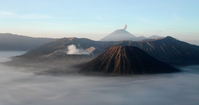
Mount Bromo (Indonesian: Gunung Bromo), is an active volcano and part of the Tengger massif, in East Java, Indonesia. At 2,329 metres (7,641 ft) it is not the highest peak of the massif, but is the most well known. The massif area is one of the most visited tourist attractions in East Java, Indonesia. The volcano belongs to the Bromo Tengger Semeru National Park. The name of Bromo derived from Javanese pronunciation of Brahma, the Hindu creator god.

Mount Bromo sits in the middle of a vast plain called the “Sea of Sand” (Javanese: Segara Wedi or Indonesian: Lautan Pasir), a protected nature reserve since 1919. The typical way to visit Mount Bromo is from the nearby mountain village of Cemoro Lawang. From there it is possible to walk to the volcano in about 45 minutes, but it is also possible to take an organised jeep tour, which includes a stop at the viewpoint on Mount Penanjakan (2,770 m or 9,088 ft) (Indonesian: Gunung Penanjakan). The best views from Mount Bromo to the Sand Sea below and the surrounding volcanoes are at sunrise. The viewpoint on Mount Penanjakan can also be reached on foot in about two hours. From inside the caldera, sulfur is collected by workers.

Culture

On the fourteenth day of the Hindu festival of Yadnya Kasada, the Tenggerese people of Probolinggo, East Java, travel up the mountain in order to make offerings of fruit, rice, vegetables, flowers and sacrifices of livestock to the mountain gods by throwing them into the caldera of the volcano. The origin of the ritual lies in the 15th century legend where a princess named Roro Anteng started the principality of Tengger with her husband, Joko Seger. The couple were childless and therefore beseeched the assistance of the mountain gods. The gods granted them 24 children but stipulated that the 25th child, named Kesuma, must be thrown into the volcano as human sacrifice. The gods’ request was implemented. The tradition of throwing sacrifices into the volcano to appease these ancient deities continues today and called Yadnya Kasada ceremony. Though fraught with danger, some locals risk climbing down into the crater in an attempt to recollect the sacrificed goods that believed could bring them good luck.

On the Segara Wedi sand plain sits a Hindu temple called Pura Luhur Poten. The temple holds a significant importance to the Tenggerese scatter across the mountainous villages such as Ngadisari, Wonokitri, Ngadas, Argosari, Ranu Prani, Ledok Ombo and Wonokerso. The temple organized annual Yadnya Kasada ceremony which lasts for about one month. On the 14th day, the Tenggerese will congregate at Pura Luhur Poten to ask for blessings from Ida Sang Hyang Widi Wasa and God of Mahameru (Mount Semeru). Then the mass will proceed along the crater edges of Mt Bromo where offerings will be thrown into the crater. The major difference between this temple with the Balinese ones are the type of stones and building materials. Pura Luhur Poten uses natural black stones from volcanoes nearby, while Balinese temples mostly made from red bricks. Inside this pura, there are several buildings and enclosures aligned in Mandala zone composition

Activity

[edit] 2004 eruptions

Mount Bromo erupted in 2004, that eruptive episode led to the death of two people.[citation needed]

[edit] 2010 eruptions

On Tuesday, 23 November 2010, 16.30 WIB (Western Indonesian Time), the Indonesian Centre of Vulcanology and Geology Hazard Mitigation (CVGHM) confirmed the activity status of Mount Bromo at “alert” due to increasing tremor activity and shallow volcanic earthquakes at the mountain.[4] Concerns were raised that a volcanic eruption may be likely to occur. As a precaution local residents and tourists were instructed to remain clear of an area within radius three kilometres from the caldera and refugee encampments were erected. The area surrounding the Teggera caldera of Bromo remained off limits for visitors throughout the remaining part of 2010.

Bromo started to erupt ash on Friday 26 November 2010.[5]

On 29 November 2010 Transport Ministry spokesman Bambang Ervan announced that Malang’s domestic airport, would be closed until 4 December 2010. Malang a city of about 800,000 people is about 25 km (16 mi) west of Mount Bromo. Abdul Rachman Saleh Airport IATA:MLG normally handles 10 daily domestic flights from the capital Jakarta. Government volcanologist Surono reported that the volcano was spitting columns of ash some 700 metres (2,300 feet) into the sky.

2011 eruptions

Bromo eruption January 22, 2011 at 5:30 am (Bromo volcano crater itself is not visible)

The Tengger Caldera was still active in late January 2011, the activity being characterised by fluctuating ongoing eruptions. On 23 January 2011 the Indonesian Centre for Volcanology and Geological Hazard Mitigation (CVGHM) (Pusat Vulkanologi dan Mitigasi Bencana Geologi) reported that since 19 December, 2010 volcanic ash and incandescent material had been thrown up by eruptive activity resulting in a heavy rain of material that fell around the crater. Continuous eruptions on 21 January caused a thin ash fall mainly in the village areas of Ngadirejo and Sukapura Wonokerto in Probolinggo district. The impact of a heavy rain of volcanic ash from eruptions since 19 December 2010 resulted in disruption of normal activities. By early 2011 concerns were being raised concerning the effect upon the local economy and the potential for long term environmental and health problems amongst the residents in the locality surrounding Mount Bromo. Due to high seasonal rainfall in January 2011 the potential for lahar and lava flow was raised due to the deposits of volcanic ash, sand and other ejected material that had built up. Seismic activity was dominated by tremor vibration and reports of visual intensity and sounds of eruption continued to be reported from the mountain monitoring facility, Bromo Observation Post. People living on the banks of the Perahu Ravine, Nganten Ravine and Sukapura River were alerted to the possibility of lava flows, especially when it was raining heavily in the area around Cemorolawang, Ngadisari and Ngadirejo. Eruptions and volcanic tremors were reported on 21 January and 22 January with activity subsiding on 23 January 2011. On 23 January, 2011 at 06:00 am the alert status at Mount Bromo remained at (Level III).[7]

On 23 January 2011 an exclusion zone was recommended for communities living around Mount Bromo. Tourists and hikers were to advised not to come within a radius of 2 km from the active crater. CVGHM stated that they expected warning signs to be installed stating the limit radius of 2 km from the crater. Operational caution was recommended for flights into and leaving Juanda International Airport IATA:SUB in Surabaya. CVGHM recommended the establishment of public areas for the provision of face masks and eye protection. CVGHM also issued a warning to residents to be cautious of ash build up on roofs and other places that may give cause for collapse under the burden of ash.[8]

Further eruptions and the issuing of Aviation Ash advisories on 27 January and 28 January 2011 led to concerns being raised regarding a volcanic ash plume, reported to be drifting eastward toward the air corridors used to access the Ngurah Rai International Airport IATA:DPS in Bali. Airport official Sherly Yunita was reported at the time as stating that concerns about visibility had prompted Singapore Airlines, Jetstar-ValueAir, Air France-KLM, Virgin Blue and Cathay Pacific to cancel several flights to Bali, 340 km (210 mi) to the east.[9][10] SilkAir also cancelled flights on the 27 January between Singapore and Lombok, an island to the east of Bali.[11] The Volcanic Ash Advisory Centre in Darwin, Australia released several Code Red Aviation Ash Advisories pertaining to Mount Bromo (Tengger Caldera), on 27 January. They indicated that ash was observed at altitudes up to 18,000 ft (FL180) extending 200 nautical mi to the south east of the caldera. In other ash advisories of that day the cloud was reported as at times having a 10 km/h drift, both to the east, and to the south east.

Deformation-late November 2010-late January 2011

  • Tiltmeter
The Indonesian Centre for Volcanology and Geological Hazard Mitigation (CVGHM) reported on 13 January 2011, that deformation using tiltmeter measurements indicated an inflation at rate of 5 micro radians between 25 November 2010 and 14 December 2010 and a relatively stable since 15 December, 2010 both on Radial Components and Tangential Components.
  • EDM
Deformation measurement using EDM compared observations at designated measuring points; POS-BRO, POS-KUR and POS-BAT during the period 25 November 2010 – 20 December 2010 with observations from the period 21 December 2010 – 30 December 2010 indicated the shortening of the distance from the POS-BAT, or inflation. Observations between 30 December 2010 to 23 January 2011 were reported as relatively stable.[13]

Gallery

  • View into the Mount Bromo crater

  • Pathway leading to Mount Bromo caldera

  • Mount Bromo eruption 22 January 2011

  • Ash plume from Bromo over Bali, 27 January 2011

Mount Merapi

Standard


mount merapi

mount merapi

Mount Merapi

From Wikipedia, the free encyclopedia

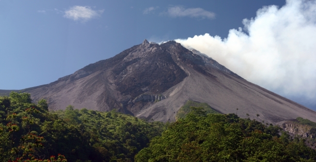
Mount Merapi, Gunung Merapi (literally Fire Mountain in Indonesian/Javanese), is an active stratovolcano located on the border between Central Java and Yogyakarta, Indonesia. It is the most active volcano in Indonesia and has erupted regularly since 1548. It is located approximately 28 kilometres (17 mi) north of Yogyakarta city, and thousands of people live on the flanks of the volcano, with villages as high as 1,700 metres (5,600 ft) above sea level.

The name Merapi could be loosely translated as ‘Mountain of Fire’. The etymology of the name came from Meru-Api; from the Javanese combined words; Meru means “mountain” refer to mythical mountain of Gods in Hinduism, and api means “fire”. Smoke can be seen emerging from the mountaintop at least 300 days a year, and several eruptions have caused fatalities. Hot gas from a large explosion killed 27 people on 22 November in 1994, mostly in the town of Muntilan, west of the volcano.[3] Another large eruption occurred in 2006, shortly before the Yogyakarta earthquake. In light of the hazards that Merapi poses to populated areas, it has been designated as one of the Decade Volcanoes.

On 25 October 2010 the Indonesian government raised the alert for Mount Merapi to its highest level and warned villagers in threatened areas to move to safer ground. People living within a 20 km (12.5 mile) zone were told to evacuate. Officials said about 500 volcanic earthquakes had been recorded on the mountain over the weekend of 23–24 October, and that the magma had risen to about 1 kilometre (3,300 ft) below the surface due to the seismic activity.[4] On the afternoon of 25 October 2010 Mount Merapi erupted lava from its southern and southeastern slopes.[5]

The mountain was still erupting on 30 November 2010 however due to lowered eruptive activity on 3 December 2010 the official alert status was reduced to level 3.[

Mythology

Merapi is very important to Javanese, especially those living around its crater. As such, there are many myths and beliefs attached to Merapi.

[edit] Creation

Although most nearby villages have their own myths about the creation of Mount Merapi, they have numerous commonalities. It is believed that when the gods had just created the Earth, Java was unbalanced because of the placement of Mount Jamurdipo on the west end of the island. In order to assure balance, the gods (generally represented by Batara Guru) ordered the mountain to be moved to the centre of Java. However, two armourers, Empu Rama and Empu Permadi, were already forging a sacred keris at the site where Mount Jamurdipo was to be moved. The gods warned them that they would be moving a mountain there, and that they should leave; Empu Rama and Empu Permadi ignored that warning. In anger, the gods buried Empu Rama and Empu Permadi under Mount Jamurdipo; their spirits later became the rulers of all mystical beings in the area. In memory of them, Mount Jamurdipo was later renamed Mount Merapi, which means “fire of Rama and Permadi.”[7]

Spirit Kraton of Merapi

The Javanese believe that the Earth is not only populated by human beings, but also by spirits (makhluk halus). Villages near Merapi believe that one of the palaces (in Javanese kraton) used by the rulers of the spirit kingdom lies inside Merapi, ruled by Empu Rama and Empu Permadi. This palace is said to be a spiritual counterpart to the Yogyakarta Sultanate, complete with roads, soldiers, princes, vehicles, and domesticated animals. Besides the rulers, the palace is said to also be populated by the spirits of ancestors who died as righteous people. The spirits of these ancestors are said to live in the palace as royal servants (abdi dalem), occasionally visiting their descendants in dreams to give prophecies or warnings. “[8]

Geological history

Merapi before 2007 eruption.

Merapi is the youngest in a group of volcanoes in southern Java. It is situated at a subduction zone, where the Indo-Australian Plate is sliding beneath the Eurasian Plate. It is one of at least 129 active volcanoes in Indonesia, part of the volcano is located in the Southeastern part of the Pacific Ring of Fire–a section of fault lines stretching from the Western Hemisphere through Japan and South East Asia.[9] Stratigraphic analysis reveals that eruptions in the Merapi area began about 400,000 years ago, and from then until about 10,000 years ago, eruptions were typically effusive, and the out flowing lava emitted was basaltic. Since then, eruptions have become more explosive, with viscous andesitic lavas often generating lava domes. Dome collapse has often generated pyroclastic flows, and larger explosions, which have resulted in eruption columns, have also generated pyroclastic flows through column collapse.

Merapi in 1930

Typically, small eruptions occur every two to three years, and larger ones every 10–15 years or so. Notable eruptions, often causing many deaths, have occurred in 1006, 1786, 1822, 1872, and 1930—when thirteen villages were destroyed and 1400 people killed by pyroclastic flows.

A very large eruption in 1006 is claimed to have covered all of central Java with ash. The volcanic devastation is claimed to have led to the collapse of the Hindu Kingdom of Mataram; however, there is insufficient evidence from that era for this to be substantiated.

2006 eruption

Pyroclastic flows (2006)

In April 2006, increased seismicity at more regular intervals and a detected bulge in the volcano’s cone indicated that fresh eruptions were imminent. Authorities put the volcano’s neighboring villages on high alert and local residents prepared for a likely evacuation. On 19 April smoke from the crater reached a height of 400 metres (1,300 ft), compared to 75 metres (246 ft) the previous day. On 23 April, after nine surface tremors and some 156 multifaced quakes signalled movements of magma, some 600 elderly and infant residents of the slopes were evacuated.[10]

By early May, active lava flows had begun. On 11 May, with lava flow beginning to be constant, some 17,000 people were ordered to be evacuated from the area[11] and on 13 May, Indonesian authorities raised the alert status to the highest level, ordering the immediate evacuation of all residents on the mountain.[12] Many villagers defied the dangers posed by the volcano and returned to their villages, fearing that their livestock and crops would be vulnerable to theft.[9] Activity calmed by the middle of May.[13]

On 27 May, a 6.3 magnitude earthquake struck roughly 50 km (30 miles) southwest of Merapi, killing at least 5,000 and leaving at least 200,000 people homeless in the Yogyakarta region, heightening fears that Merapi would “blow”.[14] The quake did not appear to be a long-period oscillation, a seismic disturbance class that is increasingly associated with major volcanic eruptions. A further 11,000 villagers were evacuated on 6 June as lava and superheated clouds of gas poured repeatedly down its upper slopes towards Kaliadem, a location that was located southeast of Mt. Merapi.[15] The pyroclastic flows are known locally as “wedhus gembel” (Javanese for “shaggy goat”). There were two fatalities as the result of the eruption.

2010 eruption

Destroyed house in Cangkringan Village after the eruptions

In late October 2010 the Center for Volcanology and Geological Hazard Mitigation, Geological Agency (CVGHM), (Indonesian language—Pusat Vulkanologi & Mitigasi Bencana Geologi, Badan Geologi-PVMBG), reported that a pattern of increasing seismicity from Merapi had begun to emerge in early September.

Observers at Babadan 7 kilometres (4.3 mi) west and Kaliurang 8 kilometres (5.0 mi) south of the mountain reported hearing an avalanche on 12 September 2010. On 13 September 2010 white plumes were observed rising 800 metres (2,600 ft) above the crater. Lava dome inflation, detected since March, increased from background levels of 0.1 millimetres (0.0039 in) to 0.3 millimetres (0.012 in) per day to a rate of 11 millimetres (0.43 in) per day on 16 September. On 19 September 2010 earthquakes continued to be numerous, and the next day CVGHM raised the Alert Level to 2 (on a scale of 1–4).[16] Lava from Mount Merapi in Central Java began flowing down the Gendol River on 23–24 October signalling the likelihood of an imminent eruption.[17]

On 25 October 2010 the Indonesian government raised the alert for Mount Merapi to its highest level (4) and warned villagers in threatened areas to move to safer ground. People living within a 10 kilometres (6.2 mi) zone were told to evacuate. The evacuation orders affected at least 19,000 people; however, the number that complied at the time remained unclear to authorities.[18] Officials said about 500 volcanic earthquakes had been recorded on the mountain over the weekend of 23–24 October, and that the magma had risen to about 1 kilometre (3,300 ft) below the surface due to the seismic activity[19]

After a period of multiple eruptions considered to exceed the intensity and duration of those in 1872[20] on 10 November 2010 the intensity and frequency of eruptions was noticed to subside.[21] By this time 153 people had been reported to have been killed and 320,000 were displaced.[22] Later the eruptive activities again increased requiring a continuation of the Level 4 alert and continued provision of exclusion zones around the volcano.[23][24] By 18 November the death toll had increased to 275.[25] The toll had risen to 324 by 24 November and Syamsul Maarif, head of the National Disaster Mitigation Agency (BNPB) explained that the death toll had risen after a number of victims succumbed to severe burns and more bodies were found on the volcano’s slopes.[26]

In the aftermath of the more intensive eruptive activities in late November Yogyakarta’s Disaster Management Agency reported that there were about 500 reported cases of eruption survivors in Sleman district suffering from minor to severe psychological problems, and about 300 cases in Magelang.[27] By 3 December the death toll had risen to 353.[28]

On Friday 3 December 2010 the head of the National Disaster Management Agency (BNPB), Dr. Syamsul Maarif, M. Si, accompanied by the head of the Centre for Volcanology and Geological Hazard Mitigation CVGHM (PVMBG), Dr. Surono made a joint press release at the BNPB Command Post in Yogyakarta. As of 3 December 2010, at 09.00 am, the CVGHM (PVMBG) lowered the status of Mount Merapi to the level of “Caution Alert (Level III). They clarified that with this alert level the potential of hot ash clouds and projected incandescent material remained. The Geological Agency provided several recommendations including that there would be no community activities in the disaster prone areas and proclaimed an ongoing exclusion zone of 2.5 kilometres (1.6 mi) radius.[

Monitoring

Merapi Volcano 27 January 2007.

Merapi next to Merbabu 9 January 2008.

Mount Merapi is the site of a very active volcano monitoring program. Seismic monitoring began in 1924, with some of the volcano monitoring stations lasting until the present. The Babadan (northwest location), Selo (in the saddle between Merbabu and Merapi), and Plawangan monitoring stations have been updated with equipment over the decades since establishment. During the 1950s and early 1960s some of the stations were starved of equipment and funds, but after the 1970s considerable improvement occurred with the supply of new equipment. Some of the pre-1930 observation posts were destroyed by the 1930 eruption, and newer posts were re-located. Similarly after the 1994 eruption, the Plawangan post and equipment were moved into Kaliurang as a response to the threat of danger to the volcanological personnel at the higher point.

The eruption of 1930 was found to have been preceded by a large earthquake swarm. The network of 8 seismographs currently around the volcano allow volcanologists to accurately pinpoint the hypocentres of tremors and quakes.

A zone in which no quakes originate is found about 1.5 km below the summit, and is thought to be the location of the magma reservoir which feeds the eruptions.

Other measurements taken on the volcano include magnetic measurements and tilt measurements. Small changes in the local magnetic field have been found to coincide with eruptions, and tilt measurements reveal the inflation of the volcano caused when the magma chambers beneath it is filling up.

Lahars (a type of mudflow of pyroclastic material and water) are an important hazard on the mountain, and are caused by rain remobilizing pyroclastic flow deposits. Lahars can be detected seismically, as they cause a high-frequency seismic signal. Observations have found that about 50 mm of rain per hour is the threshold above which lahars are often generated.

To keep the volcano quiet and to appease the spirits of the mountain, the Javanese regularly bring offerings on the anniversary of the sultan of Yogyakarta‘s coronation.[30] For Yogyakarta Sultanate, Merapi holds significant cosmological symbolism, because it is forming a sacred north-south axis line between Merapi peak and Southern Ocean (Indian Ocean). The sacred axis is signified by Merapi peak in the north, the Tugu monument near Yogyakarta main train station, the axis runs along Malioboro street to Northern Alun-alun (square) across Keraton Yogyakarta (sultan palace), Southern Alun-alun, all the way to Bantul and finally reach Samas and Parangkusumo beach on the estuary of Opak river and Southern Ocean. This sacred axis connected the hyangs or spirits of mountain revered since ancient times—often identified as “Mbah Petruk” by Javanese people—The Sultan of Yogyakarta as the leader of the Javanese kingdom, and Nyi Roro Kidul as the queen of the Southern Ocean, the female ocean deity revered by Javanese people and also mythical consort of Javanese kings

Sabo Dam

There are about 90 units (30 percent) from the total 258 units of sand barriers (sabo) were damaged. The cost for recovery is about Rp.1 trillion ($116 million).[32]

[edit] National park

In 2004 an area of 6,410 hectares around Mount Merapi was established as a national park. The decision of the Ministry of Forestry to declare the park has been subsequently challenged in court by The Indonesian Forum for Environment, on grounds of lack of consultation with local residents.[33] During the 2006 eruption of the volcano it was reported that many residents were reluctant to leave because they feared their residences would be confiscated for expanding the national park.[34]

Museum

  • Merapi Museum Center, Kaliurang Street Kilometer 25.7, Pakem subdistrict, Sleman, Yogyakarta. Replica of Merapi’s Post 2010 Eruption has been done and student’s visit to the museum had increased 30 percent since the latest eruption.[
Sendang Gile Water Fall

Standard
Sendang Gile Water Fall

Sendang Gile Water Fall

Sendang Gila waterfall

From Wikipedia, the free encyclopedia
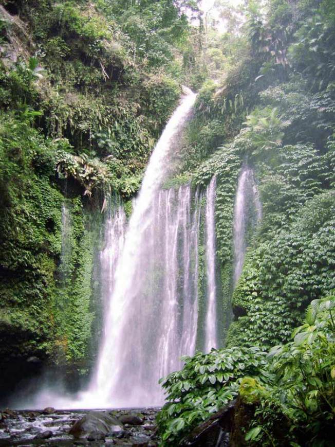
Sendang Gila waterfall (Sendang Gile), which attracts many thousands of Indonesian and foreign visitors annually, is Mount Rinjani national park’s best known attraction. Located at about 600m above sea level, the waterfall is an easy 20 minute walk down a graded trail and steps from Senaru Village, which is the main access to Mt. Rinjani National Park. A pleasant alternative return route winds along the edge of the steep valley, following the irrigation canal. For the more adventurous, the “second waterfall” Tiu Kelep, is another hour’s walk upriver from Sendang Gila. The scramble over rocks through the tropical forest is rewarded by the beauty of the waterfall and a swim in its deep pool. It is said locally that every time you swim behind the main waterfall of Tiu Kelep you become a year younger! With access from the main road, the “third waterfall” Betara Lenjang is a true rainforest adventure strictly for rock climbers with local guide and equipment.